Traversing a 3500 km stretch of Antarctica over 18 months was a humbling experience for glaciologist and marine climatologist Ian Goodwin.
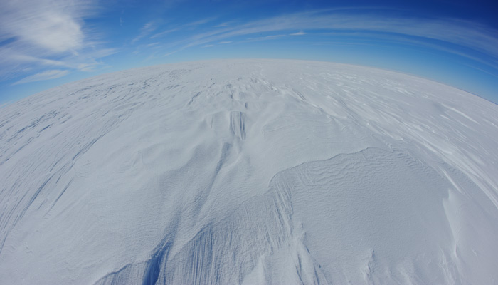
Humbling experience: Professor Ian Goodwin has spent several summers and one long, cold Antarctic winter in Wilkes Land East Antarctica.
“In those days, we thought this huge ice mass would take thousands of years to react to climate warming or cooling,” says Goodwin, whose research on the icy southern continent continues to this day.
“But over the last 10 years, we’ve realised that it actually reacts much, much faster.”
Associate Professor Goodwin is Deputy Director of Macquarie’s Marine Research Centre and has spent much of the past four decades working on climatology, oceanography and glaciology.
“One of the big unknowns and probably the most undetermined risk facing society is how fast will sea levels rise in the next hundred years,” says Goodwin, whose epic Antarctic adventure took place in the mid-1980s.
He’s working with other researchers at Curtin and Harvard universities to track geological evidence of high sea levels across the southern hemisphere during the last interglacial period to look at how these varied geographically.
Already, their research suggests that the Intergovernmental Panel on Climate Change estimate of sea level rise of one metre by 2100 due to ice sheet melt is far too conservative.
Over the past two decades, spatial data from satellite coverage of ice sheets in Greenland and Antarctica has delivered overwhelming evidence that melting and ice discharge of some outer sections of the ice sheets is speeding up.
“Disintegrating ice shelves in some locations suggests we're witnessing the beginning of a faster rate of sea level rise, as the amount of ice discharge in the ocean is rapidly increasing,” he says.
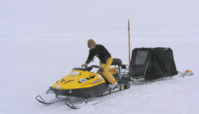
Skidoo: Professor Ian Goodwin is Deputy Director of Macquarie’s Marine Research Centre and has spent much of the past four decades working on climatology, oceanography and glaciology.
Geological ice-melt records
But we can’t make longer-term climate predictions based on the short record of instrumental observations of ice sheet variability. That’s where geological records come in.
Goodwin’s latest work involves connecting the dots between these modern data sets and geological records stretching back hundreds of thousands of years.
“By understanding spatial patterns of sea level change through time, we can try to project into the future based on the empirical evidence from the past,” he explains.
He says that these records show that the last time the earth was about two degrees warmer than pre-industrial levels, geological evidence of global coastlines show that sea levels were six to eight metres higher than today.
“We’re now in an interglacial period; and we know that sea levels were much higher during the last interglacial period, between 130,000 years ago and 118,000 years ago.”
The planet’s climate oscillations give us Ice Age cycles that span roughly 100,000 years; and sea levels vary across these timeframes depending on a range of factors.
Sea level also varies around the world, he adds.
“Each of the major ice sheets – Greenland, West Antarctica and East Antarctica – has a gravitational attraction on the ocean, like the moon has on the earth,” he says.
As a result, sea levels are higher around the ice sheets than most other locations; but there’s a sting in the tail. As ice sheets melt, the sea level around them falls. Instead, it rises in locations further from the ice sheets – like Australia.
The way that sea levels rise in different locations in response to melting ice sheets can be mapped around the world, using the “gravitational fingerprints” of sea level.
“This data will tell us which of the ice sheets – whether it's Greenland, west or east Antarctica – delivered this extra melt-water to the ocean, and therefore which of the ice sheets is most vulnerable in the coming decades,” he says.
Goodwin says that this research will give better insights into sea level rise than the ice-core drilling records which have attracted millions of dollars in research funds.
“When you drill an ice core, you're just drilling in one location, whereas looking at the global coastlines, we see the evidence for how high sea level got and can then ask, where did that water come from?”
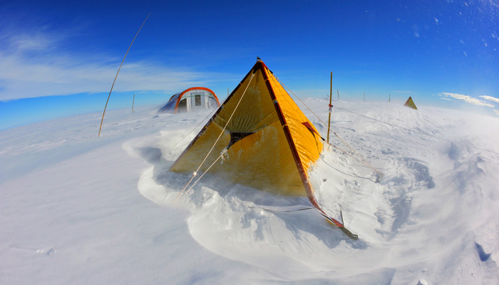
Snow dunes: Professor Goodwin spent a summer living and working at Mill Island Field camp Antarctica.
Coastline responses
The research delivers a second set of valuable insights.
“We are also investigating the coastal geology so we can understand how the coast evolved in response to those higher sea levels,” he says.
The fossilised backbone of Ningaloo reef, which spans a 250 kilometre stretch of Western Australia’s coastline some 1200 kilometres north of Perth, existed when the coastline was six metres higher, Goodwin says.
“The fossil Ningaloo reef was an equivalent ecosystem of ancient reefs, as diverse in species composition as the modern reefs,” he says.
“This is a good news story at a time when there's a great fear that we may lose the Great Barrier Reef with temperature increase and ocean acidification, but it appears that we're underestimating the resilience of the system, there seems to be processes as yet unknown to us that enabled these ancient reefs to adapt.”
Presently, local and state governments in Australia – and authorities worldwide – are spending millions of dollars preparing for an average one-metre sea level rise that IPCC reports predict for 2100.
But Goodwin says that the one-metre rise is an arbitrary level that’s not well supported by science – and that sea levels will continue to rise past 2100.
“Even if greenhouse gas emissions were capped at today's levels, and we had global agreement, we know that the ice sheets are going to continue to melt for at least another 200 or maybe 300 years until they're in equilibrium with the amount of warming that's already occurred.”
Efforts preparing for a one-metre rise could be wasted because many of those preparations should instead be considering a six to eight metre rise over time; and each site will have different likely sea level rise.
“We have this wonderful archive in our coastal sediments and rock platforms and ancient coral reefs, that actually tell us both the height the sea level got and where the shoreline was located relative to the modern coastline – and this differs from place to place,” Goodwin says.
We have to go back a very long time to find a period when sea level rose much beyond eight metres from present day heights, he says.
During the Pliocene, five million years ago, sea levels were as much as 20 metres higher than present, likely meaning that no polar ice existed at all on Greenland, and Antarctica was half the size that it is now.
“Geology has the ability to inform society about the response of the Earth's system to things such as ice-melting which have occurred in the past,” he says.
“Computer models provide us with projections based on the known physics; but when you've got empirical evidence from the geological record it's hard to refute."
Ian will present his findings at the Polar 18 Conference in Davos, Switzerland, with co-authors Mick O'Leary (Curtin) and Jerry Mitrovica (Harvard).
Their presentation, titled 'Last Interglacial Meltwater Signal from Far-field Sea-level and Proxy-climate', is scheduled for 2.45pm Davos time on 19 June.
POLAR 18 has been called "the equivalent of Comicon for Polar research."
The biannual conference is a joint event from the Scientific Committee on Antarctic Research SCAR and the International Arctic Science Committee IASC.